| id | name | url | address | description | wikipedia_url | photo_url | photo_alt | latitude | longitude | press | permanently_closed | hours | photos | map_zoom | needs_geocoding | osm_building | osm_road | osm_neighbourhood | osm_city | osm_county | osm_state | osm_postcode | osm_country | osm_country_code | extratags | namedetails | osm_museum | osm_house_number | osm_hamlet | osm_village | osm_town | osm_parking | osm_address29 | osm_residential | osm_suburb | osm_pedestrian | osm_state_district | osm_university | osm_city_district | osm_attraction | osm_restaurant | osm_garden | osm_house | osm_water | osm_cafe | osm_theme_park | osm_fire_station | osm_hotel | osm_cycleway | osm_wood | osm_archaeological_site | osm_footway | osm_nature_reserve | osm_castle | osm_address26 | osm_mall | created | updated | country |
|---|---|---|---|---|---|---|---|---|---|---|---|---|---|---|---|---|---|---|---|---|---|---|---|---|---|---|---|---|---|---|---|---|---|---|---|---|---|---|---|---|---|---|---|---|---|---|---|---|---|---|---|---|---|---|---|---|---|---|---|
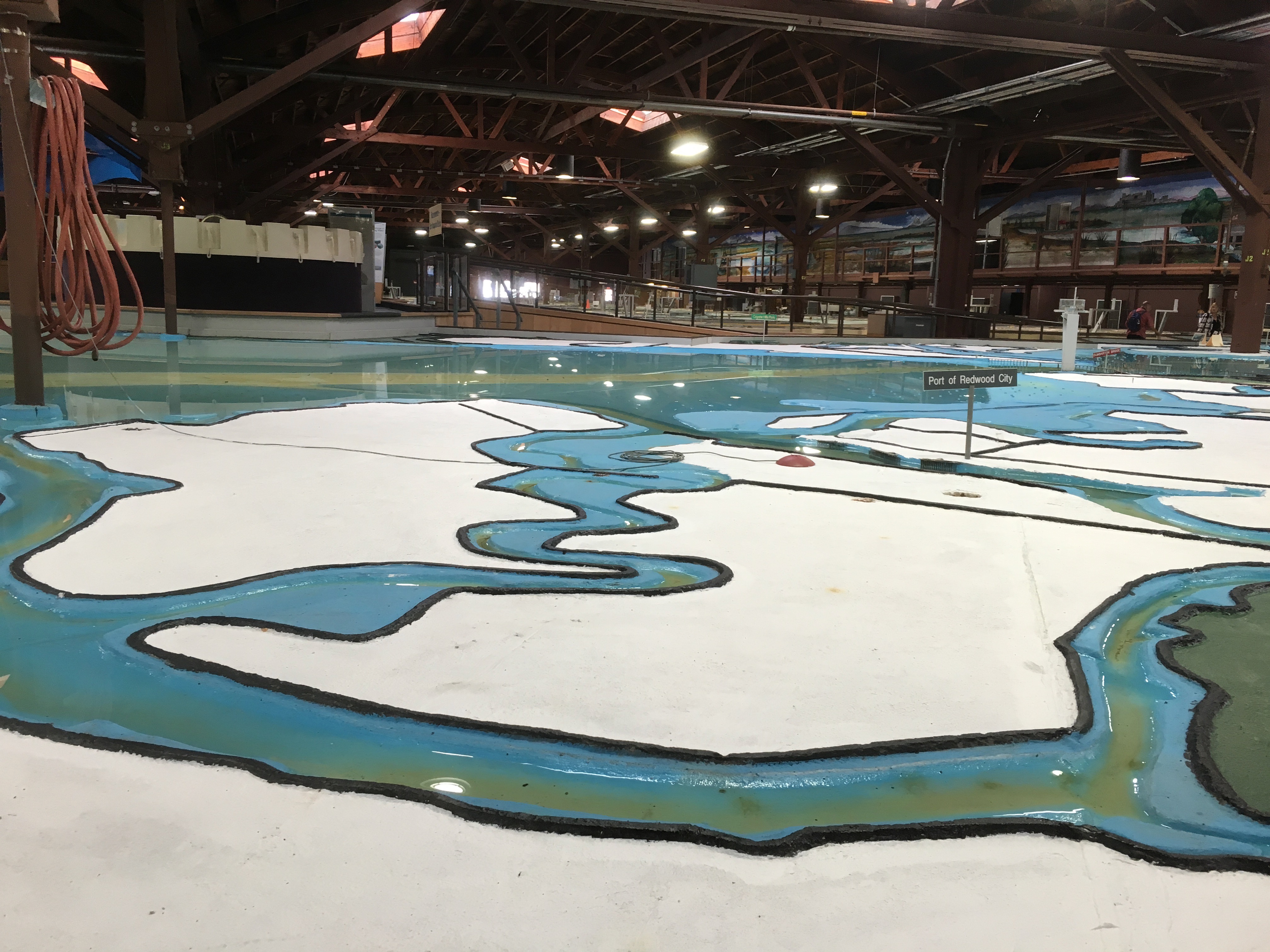
| 9 | The Bay Model | https://www.spn.usace.army.mil/Missions/Recreation/Bay-Model-Visitor-Center/ | 2100 Bridgeway, Sausalito, CA 94965 | A working hydraulic model of the San Francisco Bay and Sacramento to San Joaquin River Delta System, approximately the size of two football fields. Built by the U.S. Army Corps of Engineers in the 1950s to study the impact of proposed changes to the delta. | https://en.wikipedia.org/wiki/U.S._Army_Corps_of_Engineers_Bay_Model | https://niche-museums.imgix.net/IMG_1799.jpeg | A portion of the Bay Model | 37.8635 | -122.4948 | {
"Tuesday": [
900,
1600
],
"Wednesday": [
900,
1600
],
"Thursday": [
900,
1600
],
"Friday": [
900,
1600
],
"Saturday": [
900,
1600
]
} |
0 | Bridgeway | Marin County | California | 94965 | United States of America | us | {
"wikidata": "Q7863054",
"opening_hours": "Tu-Sa 9:00-16:00"
} |
{
    "name": "Bay Model Visitor Center"
} |
Bay Model Visitor Center | 2100 | Waldo | Sausalito | 2019-10-23T21:32:12-07:00 | 2019-10-24T19:55:37-07:00 | United States |